Author Archives: leslieromer

Prepublication Reviews

I really love the book. It’s a great one.
This book is a welcome addition to my collection of Washington hiking and climbing guides. All of the hikes in this outstanding book lead to remote summits that are off the beaten path yet incredibly accessible. The historical research and maps add background and context to the scenic points and how they were important to the region’s history.
–Mike Gauthier, author of Mount Rainier: A Climbing Guide

 Leslie Romer’s book brings the fire lookout era to life again, as well as offering wisdom and insight from one who not only has visited the sites but taken the time to observe, listen and learn what nature has to say about the past, the present and the future of the forest. There is a wealth of information, knowledge and thought to be found in these pages.
–Bryon Monohon, Forks Timber Museum Director

If you’re an admirer of Washington’s fire lookouts, seek off-the-beaten path hiking destinations, and have an appreciation for the state’s colorful logging, conservation, and war time history—you’ll want this guide on your bookshelf and in your pack.
Craig Romano, award winning guidebook author of more than 25 titles

I couldn’t stop reading! Lost Fire Lookout Hikes and Histories: Olympic Peninsula and Willapa Hills is a must-have for anyone interested in fire lookouts, Washington State history and/or hiking. The book combines interesting historic facts with detailed driving directions and trail descriptions.
–Tammy McLeod, creator of Fire Lookouts of the West Coloring Book

Author Leslie Romer not only gives the necessary information needed to visit the “lost” lookouts of Washington’s Olympics and Willapa Hills, she has painstakingly researched and updated lookout histories. I am placing my copy of Lost Fire Lookout Hikes and Histories: Olympic Peninsula and Willapa Hills on the shelf next to my well-worn copy of Kresek’s magnum opus, Fire Lookouts of the Pacific Northwest. That’s where it belongs.
–Keith Lundy Hoofnagle, Former Olympic Fire Lookout and National Park Service Ranger

When it comes to exploring the hills, doing the research and having knowledgeable contacts, Leslie leads the pack. This long-needed guide from her many site visits provides everything you need to have a wonderful fire lookout experience, even if the lookout building is long gone. The guidebook lays out the history, access and route in excellent detail, prompting the reader to want to go out and explore them.
–Eric Willhite, Peakbagger and Fire Lookout Blogger

Leslie Romer performs a major feat of archival research, as well as years of footwork, to come up with this wonderful new contribution to the Northwest’s great-outdoors bookshelf. She spells out exactly how to follow in her footsteps, and she fleshes out the experience with details of both the present plant life and the past—in words and in exhumed photos.
–Daniel Mathews, author of Cascadia Revealed: A Guide to the Plants, Animals and Geology of the Pacific Northwest Mountains

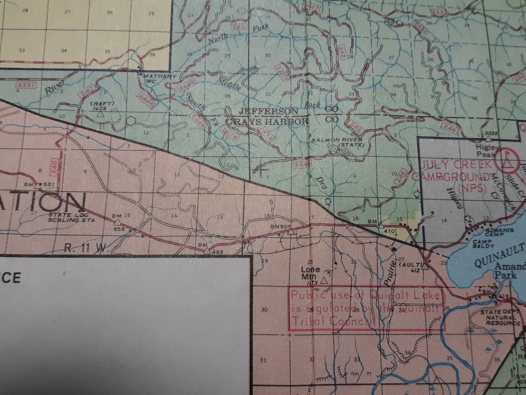
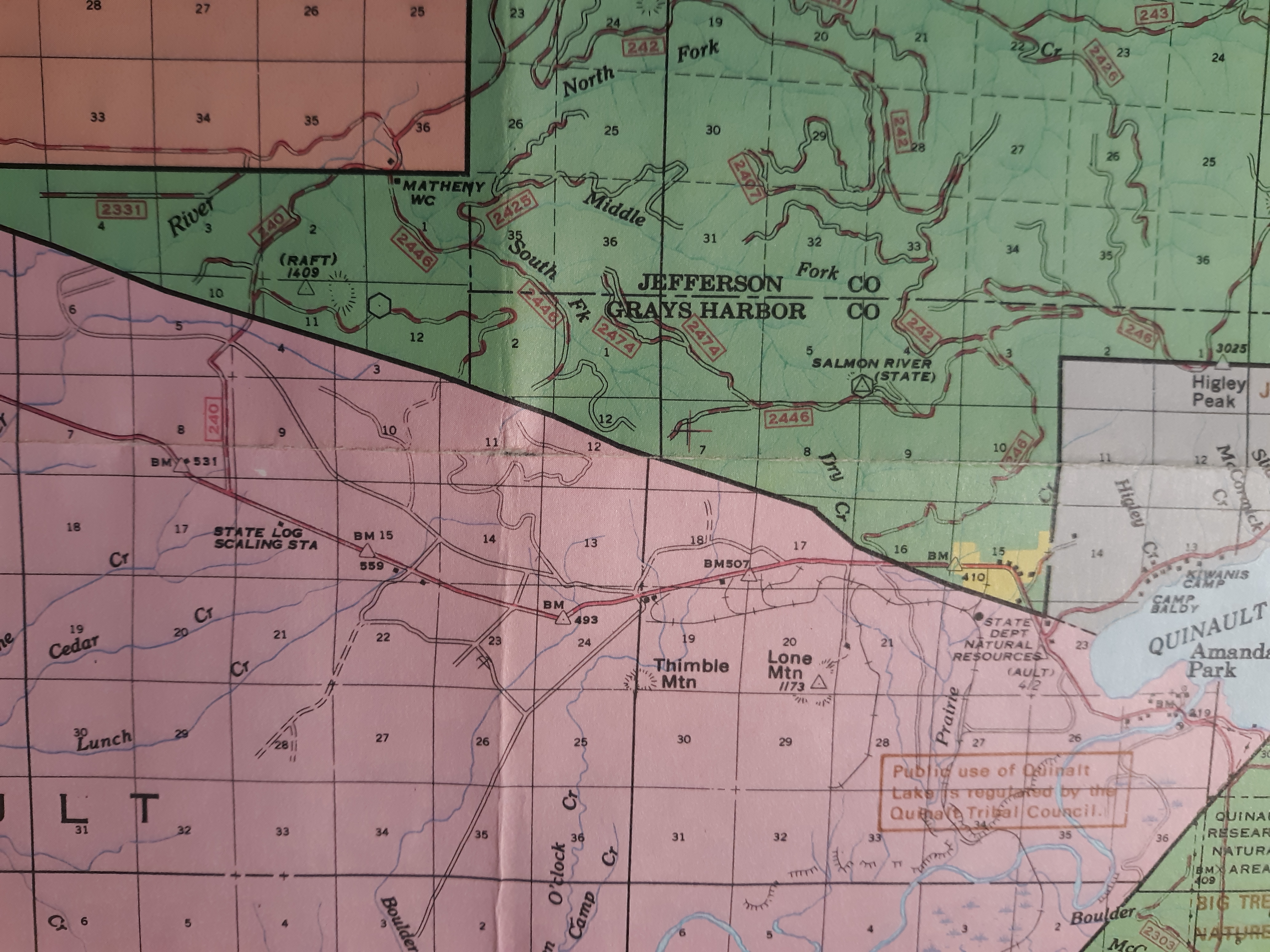
This is a magnificent book, written by an experienced hiker and environmentalist. She has specialized in hiking to old fire lookout sites and has now visited more than 500 sites, most of them in Washington State. The book contains extensive overview of 65 lookout sites in Washington´s coastal region, providing historic background as well as practical information and detailed route maps.
–Bragi Ragnarsson, Professional Hiking Guide, Reykjavik, Iceland

Part hiking guide and part history book, Leslie Romer’s Lost Fire Lookout Hikes and Histories is a richly detailed account of the long forgotten fire lookouts that once dotted the Olympic Peninsula and Willapa Hills. Romer, a backcountry enthusiast, adeptly guides the reader to the lookouts on trails just waiting to be explored.
–John Dodge, author of A Deadly Wind: The 1962 Columbus Day Storm

It is delightful…  Leslie Romer makes a difference ⁓ inspiring a search for our history while exploring our beautiful world. May her readers follow her footsteps and find their own paths.
–Molly Erickson, US Forest Service, Retired (44 years)

BAD NEWS FOR SOUTH MOUNTAIN LOOKOUT HIKERS

Sometime in the second half of 2021, free public access to the South Mountain Fire Lookout site through the surrounding private forest lands was eliminated by the Green Diamond Company. Until sometime that year, the long bicycling and hiking route to South Mountain, the southernmost peak of the Olympics, has been accessible from the Shelton˗Matlock Road, year round. Until this autumn, the forestland gates at that main road, and within the tree farm have been opened, allowing cars and trucks to drive to a gate four miles from the 3000-foot South Mountain summit, during the September through December hunting seasons. From there it has always been an enjoyable hike to the top.

Without any announcement beyond their website, Green Diamond developed and published new access maps for their forestlands in Mason and Grays Harbor Counties in 2021 (NEW – Grays Harbor/Mason County). The previous practice of press releases published in local newspapers, and listed on the company website News page: (https://www.greendiamond.com/news) was not followed. This information was probably shared within the company, and with current Recreational Access Permit holders. In the past, the public affairs office answered the phone for questions. This year no one answered the phone or returned my call to ask about the new maps.  

Continue reading

DECEMBER 2021- JANUARY 2022 REVIEWS

WTA.org December 10, 2021 blog

https://www.wta.org/news/signpost/gift-guide-13-favorite-outdoor-themed-books

“Lost Fire Lookout Hikes and Histories: Olympic Peninsula and Willapa Hills” by Leslie Romer

Our state’s rainy western flanks might not be first place you’d look for fire lookouts, but local hiker and author Leslie Romer has documented over 60 current and former lookout sites between the mouth of the Columbia River and the Strait of Juan de Fuca. Part history book and part guidebook, Romer combines years of ground-truthing with detailed, archival research to bring these oft-forgotten sites to life. “Lost Fire Lookout Hikes and Histories” lays out all the background you need to start planning your summer adventures around the Olympic Peninsula and find some truly off-the-beaten path locales.

https://www.facebook.com/people/Polson-Museum/100057288895080/, December 15 post. Published as part of a five book review in the Aberdeen Daily World:  December 16 by Jon Larson, Polson Museum Director:

For the physically active history fan, the newest addition to the local written record is Leslie Romer’s “Lost Fire Lookout Hikes and Histories: Olympic Peninsula and Willapa Hills.” Released only last week, this 330-page softback is packed with historical geography detailing 66 individual hikes to the fire lookouts that once dotted our region. The hikes themselves were chosen for being accessible to the public and range from a half mile to twenty one miles in length. While few of the lookouts remain, Romer has done exhaustive research to locate where they once stood and has created a lasting record of this once crucial network of early warning stations. With many dating to World War II and ranging from the Columbia River to the Strait of Juan de Fuca and everywhere in between (a majority here in Grays Harbor and Pacific Counties), each hike is detailed for historical context as well as for geographical accessibility. The cartography is excellent and this book is highly illustrated with historic photos. $22.95 softback.

OUR COAST WEEKEND Arts and Entertainment Weekly, January 11, 2022. Astoria, OR

https://www.discoverourcoast.com/coast-weekend/arts/bookmonger-hiking-guides-for-nearby-exploring/article_3f19f18a-6e7e-11ec-9aec-eff31b7da350.html

“Bookmonger: Hiking guides for nearby exploring”

For all of you who have dreams of getting out into nature more in 2022, here are two new books that will encourage you to do so!

“Lost Fire Lookout Hikes and Histories” offers over 60 hikes to fire lookout sites throughout the Willapa Hills and the Olympic Peninsula. In researching these destinations, Olympia, Washington, author Leslie Romer proves to be not just a doughty hiker but also a veritable scholar. 

But before you get to the section of the book that details the hikes, please read the 11 pages of preface. These contain smart advice that Romer wants to convey to anyone following in her footsteps, things like: make sure you know who owns the land where you’ll be hiking, and get the proper permits ahead of time; know the etiquette you should practice when encountering wild animals; and, don’t skimp on the Ten Essentials.

Heeding this counsel will lead to a better experience once you actually hit the trails.

Following this introduction, Romer has prepared at-a-glance tables that summarize the hikes by distance, elevation gain, seasonal access and more.

Then you’ll get to the actual hike descriptions. Each entry methodically includes an overview, driving directions to the trailhead, a map and detailed directions for the hike.

Romer also combed through archival records and pored over old maps and written guides to provide mini-histories of each site and even information about some of the folks who once staffed and supplied these lookouts. These included a Disney illustrator, a famous female horse packer, and — during World War II — Aircraft Warning Service spotters.

“Lost Fire Lookout Hikes and Histories” provides destinations that are off the beaten path.

The Bookmonger is Barbara Lloyd McMichael, who writes this weekly column focusing on the books, authors and publishers of the Pacific Northwest.

THE SKETCHY HISTORY OF THE RAFT FIRE LOOKOUT

In October 2019 I organized a slide show about local fire lookouts for The Olympians Hiking Club in Aberdeen. I planned to share photos and what I knew and remembered from visiting all of the lookout sites in Grays Harbor County. Almost all of the historic fire lookouts there had been eradicated—with almost all signs of their existence removed before twenty-first century visitors arrived on the scene.

On my list was the Raft Lookout site, which I had hiked to several times in 2008-2010. I wasn’t including it in my book, because maps now show its location on the Quinault Indian Reservation, and the tribe no longer offers recreation permits for access on their lands.

To gather a little history for my presentation, I looked in the lookout inventories published in the 1980s. I noticed that Raft is listed in Byron Fish and Ira Spring’s Lookouts; Fire Watchers of the Olympics and Cascades, but does not appear in either of Ray Kresek’s books about lookouts published in the 20th century.[1] Fish and Spring list Raft lookout under the Olympic National Forest and Olympic National Park, Quinault Ranger District. It describes it as a “Lookout shown on Forest Service map and not on USGS.” They located it in “Township 23 Range 11W Section 12, 10 mi. NW of Amanda Park.’[2]

At some point, based on the research of volunteer historians and lookout hunters like me, Raft’s name was added to the updated lookout lists in both the 2015 and 2019 editions of Kresek’s Fire Lookouts of the Northwest; Lookout Inventory Revised. The line for Raft says only “Raft… (see Salmon River).”[3]

That surprised me, as I think of Raft as a federal fire lookout and Salmon River as state, so I pulled out my older maps of the region. Some have accumulated on our bookshelves along with hike guidebooks since we moved here in the 1970s, a few were gifts from older friends when they were downsizing, and one prize 1960 Quinault District Firemans [sic] Map had been sent to answer my questions about another fire lookout site. Several of these maps[4] show Raft as a forest service lookout in 1960 through 1976 at least, and Salmon River[5] as a state lookout—just as they are both listed in the Fish and Spring book.[6] At the talk, I had no photo of Raft Lookout to show, and only my map discoveries to support my scanty knowledge of Raft’s existence.

A section of the 1960 Quinault Ranger District Firemans map, marking the locations of fire lookouts in the Olympic National Forest and Quinault Indian Reservation with black triangles with white centers: Raft River Ridge and Higley Peak in the national forest, and Lone Mtn. on the reservation. This map lacks a legend interpreting the symbols used.

1972 Olympic National Forest map, showing the locations of the Raft Lookout (hexagon), Raft National Geodetic survey marker (triangle), the Salmon River Lookout (triangle within a hexagon) in the Olympic National Forest (green), and Lone Mtn. survey marker (triangle) within the Quinault Indian Reservation (pink). Fire lookout symbols were not included in the Olympic Forest and Park map legends in the 1970s or later.
1977 Olympic National Forest, Olympic National Park map, showing the locations of the Raft Lookout (hexagon), Raft National Geodetic survey marker (triangle), the Salmon River Lookout (triangle within a hexagon) in the Olympic National Forest (green), and Lone Mtn. survey marker (triangle) in the Quinault Indian Reservation (pink). Fire lookout symbols were not included in the Olympic Forest and Park map legends in the 1970s or later.

There wasn’t a large crowd for my Olympian slideshow, but a number of people stayed after the presentation to ask questions and share memories. I had hiked with more than half of the people in the room, so I anticipated hiking memories, and few questions. I was a little surprised when a frequent hiking companion from Elma mentioned that he remembered seeing the Raft Fire Lookout. He had worked for the Olympic National Forest several summers in the late 1960s, based at the Matheny Forest Service Work Camp. The Camp was located a few miles north of the Raft lookout, on Forest Road 240 (I think it is FR 21 on current maps) at the Jefferson County line.

The Raft Ridge Lookout, as he knew it, was one that his crew checked on regularly. He remembered there had been a house trailer on the site in 1968, ‘69 and 1970. His other clear memory was looking down on the Lone Mountain Lookout tower,[7] across US Highway 101 to the southeast, in the Quinault Indian Reservation. The Raft Fire Lookout, even without a tower sat at 1600΄ or 1700΄ elevation, while the Lone Mountain Tower added a 90΄ metal tower to its 1173΄ hilltop elevation.

The combination of symbols on maps and the memories of an elder forest worker resolved the Raft Lookout question for me. Byron Fish and Ira Spring were correct to trust the US Forest Service map when they included Raft as a federal Forest Service fire lookout in their 1983 book.

That left one related mystery for me—how, when and why was the land that had included both the Raft and Salmon River Fire Lookouts transferred to the Quinault Indian Nation? I recently learned the area was known as the North Boundary Expansion Area.

… But that is a story for another day.

[1] Ray Kresek, Fire Lookouts of Oregon & Washington, 1985 and Fire Lookouts of the Northwest, 1984.

[2] Fish and Spring, p. 197. [1] Kresek, 2015 and 2019, p. 23.

[3] Ray Kresek, Fire Lookouts of Oregon & Washington, 1985 and Fire Lookouts of the Northwest, 1984.

[4] Fish and Spring, p. 197.

[5] Kresek, 2015 and 2019, p. 23.

[6] Quinault Ranger District, Olympic National Forest, Firemans [sic] Map, 1960; Olympic National Forest map, 1972; Olympic National Park and Olympic National Forest. 1977.

[7] The Salmon River Lookout is documented elsewhere as in use from 1960 until about 1995.

[8] Byron Fish and Ira Spring. Lookouts; Fire Watchers of the Olympics and Cascades, 3rd edition, 1998, pp 197, 199.

[9] After several attempts, I reached Lone Mountain’s partly overgrown metal tower in September 2007. The tower was visible to travelers driving south on Highway 101 until 2012, when it was taken down for safety reasons.


Fire Lookout FAQ

FAQ: Frequently Asked Questions

•Where are all these lookouts?
• What are you working on right now?
• What else have you written?
• And when you are not writing?
• And?

Where are all these lookouts? 

I have visited over 500 fire lookout sites and standing fire lookout towers and cabins, mostly in the western US. More than 360 of them are in Washington State. Oregon: 68, Arizona: 23, New Mexico: 18, Pennsylvania: 10, California: 8, Idaho: 6, Montana: 5. Many of the lookout sites I have visited in Washington state are on private forest land which is no longer freely accessible to the public.

What are you working on right now?

 In 2022 I published Lost Fire Lookout Hikes and Histories: Olympic Peninsula and Willapa Hills, a guide to the fire lookouts and lookout sites in that region—in other words, Washington State west of Puget Sound and Interstate 5.   It includes extensive historical notes, as well as directions for driving to the trailheads and finding the sites. It includes all the lookouts and sites currently accessible without purchasing a recreation or hunting permit to private timberland. I would like to be visiting libraries, museums, and other venues where I can talk about this book. I am looking forward to opportunities to do this soon.

As the Mount Rainier Region, or central Cascade Mountain Range, is another hiking area near my home in Olympia, I have resumed visiting fire lookouts and lookout sites in that region, drafting their hike descriptions, and collecting their histories. I am delighted that a new lookout tower has been built on Pinnacle Peak, and the High Rock Lookout cabin is being restored!

What else have you written?

I completed the text for a Guide to Iceland’s Volcanoes, with their Stories a few years ago. Its Introduction earned recognition for me as a finalist in the 2015 Pacific Northwest Writers Association annual competition for non-fiction.  More recently I have written hike descriptions for the Washington Trails Association on-line hike guidebook, as well as hike reports for http://www.WTA.org. My trail name is Leslie in Oly

And when you are not writing?

I like to hike two or three days a week. I have led many small group multiday hike trips to fire lookouts in Washington, Oregon, New Mexico and Arizona, as well as volcanoes in Iceland. Recently my multiday hiking trips have been with a few friends, and I often lead local day hikes for two hiking clubs in the Olympia area. The hikes of The Olympian Hiking Club are open to the public. You can find those hikes on my Events page.

And?

There is always another interesting corner of the globe to visit.  Occasionally my husband, Henry, and some of our extended family (Geordie, Keith, Allyson, Mallory and Hope) travel with me.

Covid-19 has made me appreciate the freedom and mobility that I have so enjoyed, living in western Washington State. Staying home gave me more time to write and work on other projects at home. I have even been paying more attention to the flowers in our garden! Hiking, however, is the core of my wellness program—both physical and mental. I expect I will continue to hike and write about my discoveries as long as I am able.

Iceland FAQ

FAQ: Frequently Asked Questions

• How did you get so interested in Iceland?
• Have you been to Iceland much?
• Did you publish your book about Iceland?
• What else have you written?
• Do you do talks about travel in Iceland?
• And when you are not writing?
• And?

How did you get so interested in Iceland?

I went on a summer hiking tour in August 2007 and knew I wanted to see more of that amazing landscape. After a few trips I realized that the landscape is entirely volcanic, and that is the key to understanding what I am seeing. When I started learning about the volcanoes’ history, I heard and read folktales and historic anecdotes about them, too.

Have you been to Iceland much?

I spent a couple weeks in Iceland every year from 2007 through 2017. I explored new areas on each trip, which is pretty cool since the island isn’t all that big. I was in Reykjavik for a few days each of the last few years. In September 2018 I was with a Viking Cruise “In the Wake of the Vikings.” In late summer 2019 my husband, Henry, and I stayed in Reykjavik in transit between Greenland and Newfoundland, visiting Viking settlement sites in those Western Atlantic locations.

Did you publish your book about Iceland?

No, I did complete a manuscript for a book on Iceland’s volcanoes and their stories a few years ago. Despite the book’s Introduction earning me Finalist status in the 2015 Pacific Northwest Writers Association non-fiction writers contest, the book gained no interest from publishers. The inability to get permission to include photos of historical volcanic eruptions in a self-published book was the final straw. The manuscript is on the shelf. Its currency aging with each new eruption and visitors center opening. The text includes stories about each of the volcanoes because they help distinguish the geologic features—and because the tales are important to Icelandic culture.

What else have you written?

Recently I have contributed hike descriptions to the Washington Trails Association guidebook on line at WTA.org. The International Travel News published an article I wrote after one of my trips to Iceland: (www.intltravelnews.com/2009/01/ reflections-on-southern-iceland). I have done a couple short pieces for The Mountaineers Magazine about historic forest fire lookoutshttp://www.mountaineers.org/about/ magarchive/Mtr01-12.pdf p.38 and http://www.mountaineers.org/about/magarchive/Mtr03-12.pdf p.15). . For a while I explored interesting local environmental issues in articles for the South Sound Green Pages. Before that I wrote a lot of government reports—complex environmental and financial info written clearly for general readers. www.fortress.wa.gov/ecy/publications/summarypages/98703.html, https://fortress.wa.gov/ecy/publications/summarypages/99750.html

Do you do talks about travel in Iceland?

I love to share my photos and information about Iceland and its culture. I have given slideshows to outdoor clubs, libraries and senior centers. If you would like me to speak to your group, let me know and let’s see what we can work out.

And when you are not writing?

As you might suspect from the non-Iceland posts, I love to hike and explore the outdoors—mostly in the Pacific Northwest. When there is decent snow, I enjoy Nordic skiing. I don’t bike and paddle as much as I would like. And I dream about more international travel!

And?

My husband blogs about creative solutions to the weight of backpacking equipment. We don’t have any pets but I do have visitation privileges to a herd of Icelandic sheep and a great view of the Independence Valley from the ridge where my Icelandic tutor lives.

Goðan daginn!

THE WEATHERWAX MYSTERY PARTLY RESOLVED:

The two published inventories that I rely on for basic location and historical information disagree on the location of this fire lookout. Ray Kresek’s list reports it in Section 9 of Township 21 North, Range 7 West. Spring and Fish said it was diagonally northwest of Kresek’s location, in section 6 of the same Township and Range.[1] When I started looking into the known details about Weatherwax, I realized I had always followed my hiking club’s traditional route, and looked for Weatherwax lookout artifacts at the feet of a set of communication towers in Section 5, even farther west.

In 2017 I was searching though old maps to resolve a different question and discovered a copy of the Osborne firefinder map for the Weatherwax fire lookout. Right at the top of the page it gives the location: “SW¼ SE ¼ SW¼ S.4 T21 N. R.7 W.”  This can be read as “the southwest quarter of the southeast quarter of the southwest quarter of Section 4 in Township 21 north, Range 7 west.” I had been offered a copy of the old map by a Weyerhaeuser employee in Grays Harbor County a decade before and had accepted it among other old maps “just in case.” I finally knew why.

When I compared the Osborne map with my contemporary maps I realized the fire tower location was clearly within the Olympic National Forest. I had read about state and national lookout staff sharing a tower, but not of any lookouts that were built on the other jurisdiction’s land. But I was able to confirm the lookout tower’s location with former state forest lookout staffer Keith Hoofnagle in 2017. ‘Yes,’ he said. ‘I knew when I worked there that the tower was on federal land. There was nothing secret about it.”

The tower had been there six years when Keith started work there. Section 4 is clearly in the Olympic National Forest, and always has been. So how did the state fire tower come to be built on federal land? The logical reason is that it has higher elevation than any nearby state or privately owned land and publicly employed foresters worked cooperatively in that era.

The question remains: Why did the two inventories list different incorrect locations? If  I ever figure that out, I will be sure to let you know!.


[1] Ray Kresek, Fire Lookouts of the Northwest; Lookout Inventory,. 2019, p. 24. Ira Spring and Byron Fish, Lookouts; firewatchers of the Cascades and Olympics. 2nd ed., 1996, p.199.

UPDATE ON THE ARCTIC LOOKOUT

(Really Bad News – Early 2023)

The State (Division of Forestry, at the time) built a 54΄ pole tower with cabin on top on a ridge west of the Artic* town site in 1948 and took it down in 1973. Until a decade ago, hikers visiting the site followed the first side road leading to it—through a Weyerhaeuser tree farm. When Weyerhaeuser started charging steep recreation fees in the Twin Harbors Tree Farm in Grays Harbor County, hikers looked for another route.

In general terms, the lookout site is located south of Aberdeen and Cosmopolis, west of U.S. Highway 101. To be specific, drive U.S. Highway 101 south past milepost 75 and turn right on Hilliard Lane, just before the North River Bridge. Drive 5.5 miles to the Hancock Forest Management gate that blocks the road, and park. A sign beside the gate welcomes non-motorized recreation beyond that point.

This route to the Arctic Lookout follows Forest Road LD4010/EF4213, as described below. Unfortunately, that route gained a new ownership sign by March of 2023.  I discovered an American Forest Management sign about a half mile up the forest road while attempting to lead The Olympians Hiking Club there. AFM has a recreation permit system, but appears to focus on leasing acreage, rather than access to forest roads. There went another forest neighborhood!

I don’t recommend trespassing, especially since the sign mentions a camera recording visitors. I offer these directions just for historic purposes:

Follow that route to a Y and continue straight on LD4011/AN4310. This road snakes up to a ridge that provides great views into the North River Valley. The hillside has been harvested, so the landscape presents as a patchwork of forest, fields, narrow roads and streamlines.

About 2.5 miles from the Hancock gate, and a short distance before the spur road leading to the Arctic Lookout site, is another gate. Now for the bad news: in summer 2019 a new sign appeared beside this gate. Rayonier Timber Company now requires a hunting lease for entry here. This area does not appear among the Rayonier properties that can be visited with a 2019 Non-Hunting General Access permit—$135 for a family pass. Perhaps it will next year. You can check their website https://property.rayonierhunting.com/Permits/PermitDetails.aspx to see if that has become available.

            ‘* Are you wondering why there are two spellings of Arctic here? The lookout was named for a little town which locals hoped to name “Arta” for the wife of the town’s founder.[1] Their application for a post office was not clearly written, and Artic was the name that came back from the US Postal Service. The state agency, fifty miles away in Olympia, used the more conventional spelling of the name.


[1] James W. Phillips. Washington State Place Names, 1971. p.9.

ICELAND 2016 6. SKJALDBREIÐUR

I have wanted to hike up Skjaldbreiður for most of the decade I have been visiting Iceland. Its name means broad shield and it is the prototype of a shield volcano. It sits on the horizon each time I visit the historic Thingvellir National Park, reminding me of my first attempt to reach its summit in 2010. I came to Iceland in early September that year, later than usual. Late August had always seemed to have reasonable weather, so why not September? But that year the weather gods (most likely Thor) did not cooperate. The skies were usually cloudy, and temps cooler than expected. Bragi and I tried a hike up Snæfellsjökull, a big glaciated mountain northwest of Reykjavik, but the sno-cat tracks we planned to follow were buried in early season snow, the possibility of crevasses lay beneath that light layer, and clouds kept drifting across our landscape, making navigation a continual challenge. We enjoyed early progress up the mountain, but decided not to risk our safety in the chancy conditions and returned downhill after hiking a couple miles.

We were scheduled to hike Skjaldbreiður the next day of that tour in 2010, but the weather started misty and only got worse as we approached the mountain. I recognized the driving route as far as the turn from northbound Highway 1 toward Thingvellir on Route 36. When the road to the Thingvellir National Park headed east, we drove north on two lane Highway 52. As the road started gaining elevation the mist turned to rain and then snow. Then the wind rose and it really did not look like a good day for a hike up a tree-less volcanic mountain. Bragi did not like disappointing me two days in a row, and drove as far toward the trailhead as he could. I was ready to turn around as soon as the snow started, but he wanted to make sure it was not just a brief shower. Later we learned that we had experienced the start of a severe and totally unexpected early-season blizzard. Many farmers had left their animals out in the weather, and a lot of sheep were lost in the several feet of snow that fell in the highlands and remote rural areas.

I think I had put Skjaldbreiður on itineraries a few times during the years in between, but either the weather or the schedule had not worked out. I was hopeful this year, but not totally optimistic. I had looked at an Icelandic hiking guidebook (Ari Trausti Guðmundsson’s Íslensk fjöll : gönguleiðir á 151 tind) before this year′s trip. It describes the hike as longer with more elevation gain than I had expected: 9 miles distance round-trip and almost 2000 feet to climb. The one good change since the last time I had planned to hike the peak was that jeeps and motorbikes were no longer allowed to join hikers on the ascent. Conservationists had won the battle to save this and some other scenic peaks from motorized mountain climbs.

The weather on the day we picked to hike up Skjaldbreiður this year did not look promising. We left Reykjavik in mist that was thick enough to require windshield wipers to clear our view. I recognized the gravel road on the west side of Skjaldbreiður as soon as we left the pavement and wondered if the weather would chase us from its approach yet again. When we turned onto the road on the north side of the mountain, the rain lightened. When Bragi parked the car at the trailhead, the rain stopped. We climbed out, put on our boots, and the weather held. Perhaps we would be successful!

Bragi had told us there is a big crater full of snow just under the summit ridge. As we started hiking up the trackless north slope, large snowfields appeared below the rocky top. It didn´t seem far away, but I could not tell whether the snow we saw was in a basin like a crater, or was just a sloping mountainside covered in white.

As we ascended, our views of the surrounding landscape grew around us. First we could only see rocky ridges across the narrow valley of our immediate vicinity. As we reached the snowfields on the upper slopes we started to see the large glacier fields of Langjökull farther north. I was surprised how quickly we climbed the mountain with no

20160801_141737

Langjokull’s glacier fields on the distant ridges

trail. It certainly did not seem as far or as steep as the guidebook suggested. For some reason my boots did not give me as good traction on the snow as Bragi and Susan had. So I took a slightly longer route on the rocky edge of the snowfield. While not smooth, the surface underfoot was not too lumpy, so I was able to keep up with my companions′ pace and followed a parallel route up the mountain.

I caught up as they started to climb the short rocky traverse to the ridge top. It was no more than a twenty-foot ascent on rocks that seemed piled like stairs. There were also flat rocks on the ridge available for sitting and enjoying the view of the snow-filled crater20160801_133043

Looking down into the crater

and its black perimeter, and a climb of a few more feet to the highest point on the north side. Almost as soon as we sat down to enjoy the views and our lunches, Bragi´s phone rang and we heard him tell someone where we were and how clear our view was. ‘‘Rain? No, we have none of that here.” We were surprised to learn that we were apparently at one of the few spots in Iceland without rain that day.

My GPS reported we had hiked three miles and gained only 1000 feet on our way to the top. Bragi had certainly found an easy route for us. He said it was the usual way for local hikers, but it is clear that a symmetrical mountain, which a shield volcano must be, may well offer a variety of access paths. We thoroughly enjoyed ours.

On the way down we paid more attention to the late summer vegetation on the20160801_153423 
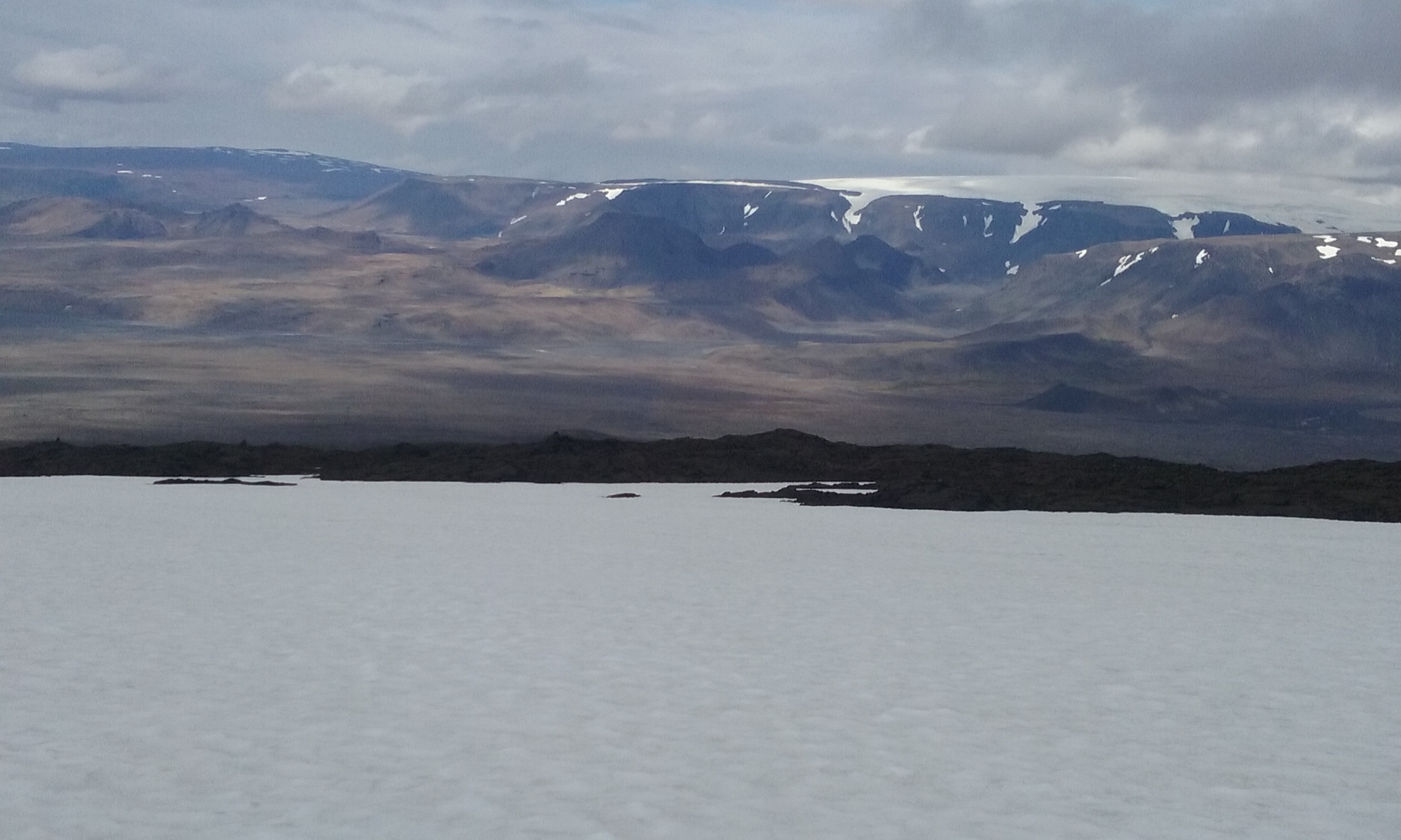
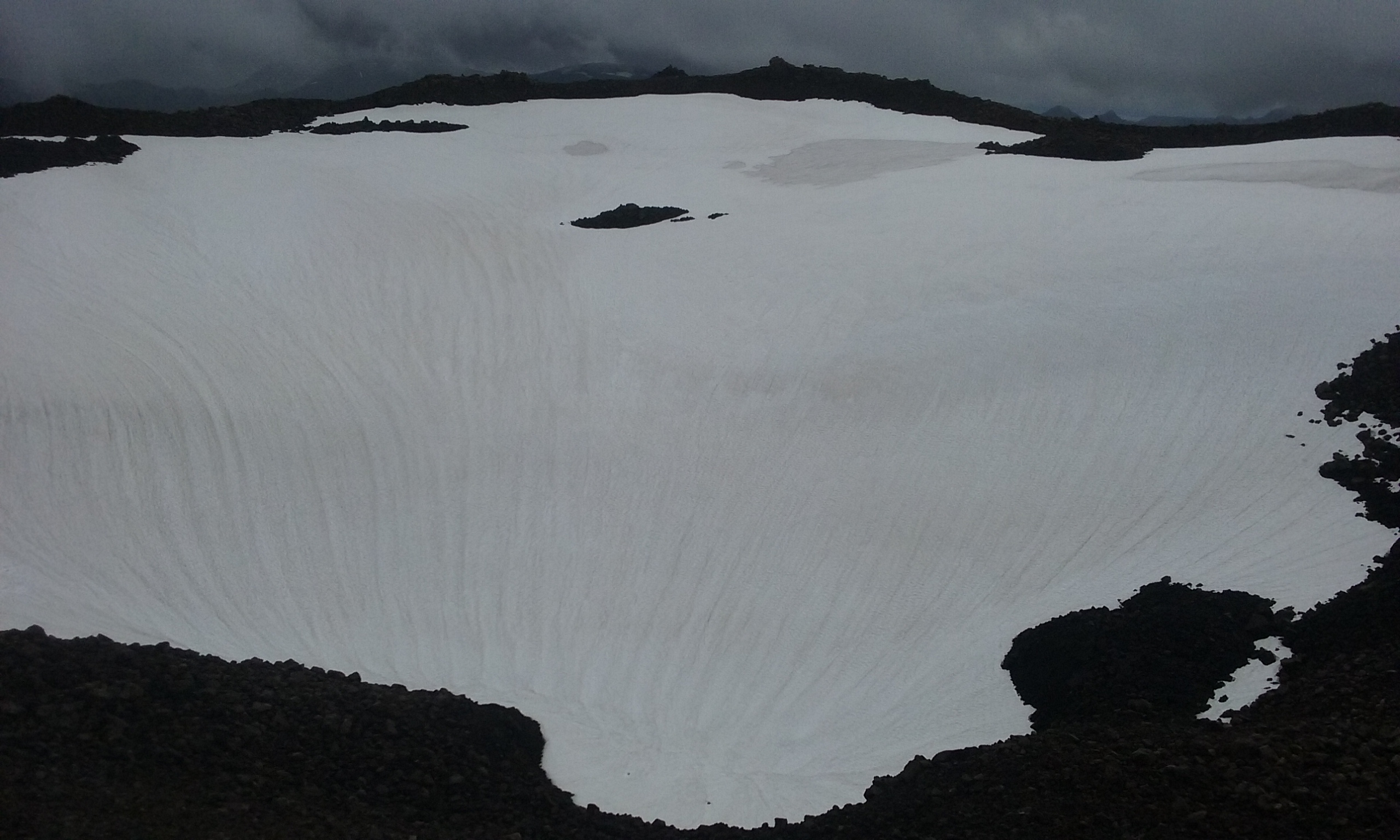
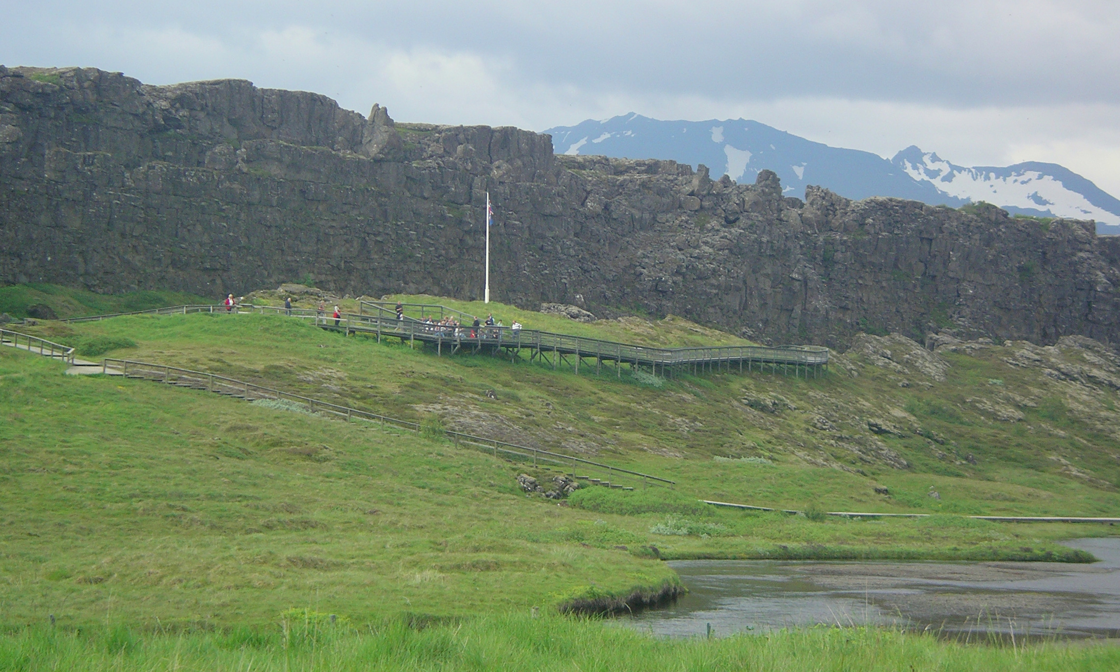
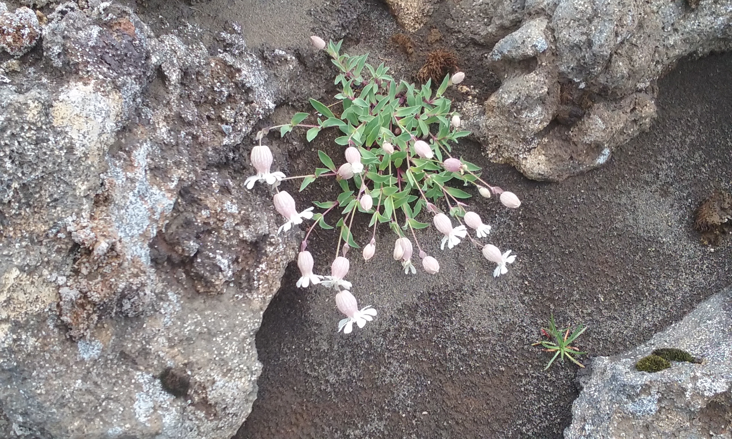
slope: bladder campion, mosses, and a variety of grasses. We also noticed wonderful patterns in the undisturbed lava. And we observed dark clouds headed in our direction again. Finally the car came into view and we began to wonder if we would reach the car first. We succeeded, but not by much. We jumped inside and changed out of our hiking boots as the rain began its tattoo on the roof.p1030086

Our lodging that night was at the Efri-Sel Hostel, quite close to a similarly named golf course and just outside the town of Fluðir. The golf traffic supports an associated cafe, and we joined the family-dominated crowd there for burgers.

The hostel is a very comfortable modern house on a farm property, providing a kitchen, dining and lounge area laid out to encourage guests to join in general conversation and get acquainted with other visitors. We enjoyed meeting international couples from Germany and Ireland, South Africa and Taiwan, and England. Other assets of the house are laundry machines and a roomy hot tub –both of which we enjoyed using.

ICELAND 2016 5. Hiking at Ulfljótsvatn, Nesjavellir and Visiting Thingvellir

This was intended to be a recovery day after a big hike. But yesterday’s full day hike had turned into a moderate afternoon hike, so we had lots of energy for exploring the area near the Ljosafoss Skóli Hostel. Susan and I had noticed a nearby lake on our map that appeared to have a shoreline trail. Bragi remembered a gravel road that led to the trail, so off we went—with his warning that it might a buggy hike beside the water.

We parked at the top of a steep hill, and headed down to Ulfljótsvatn. Despite the homes sitting beside the road approaching the pretty blue lake, there were no boats on the surface or walkers on the shoreline. Once we reached level ground, all the houses were out of sight and we had the place to ourselves.20160731_032402
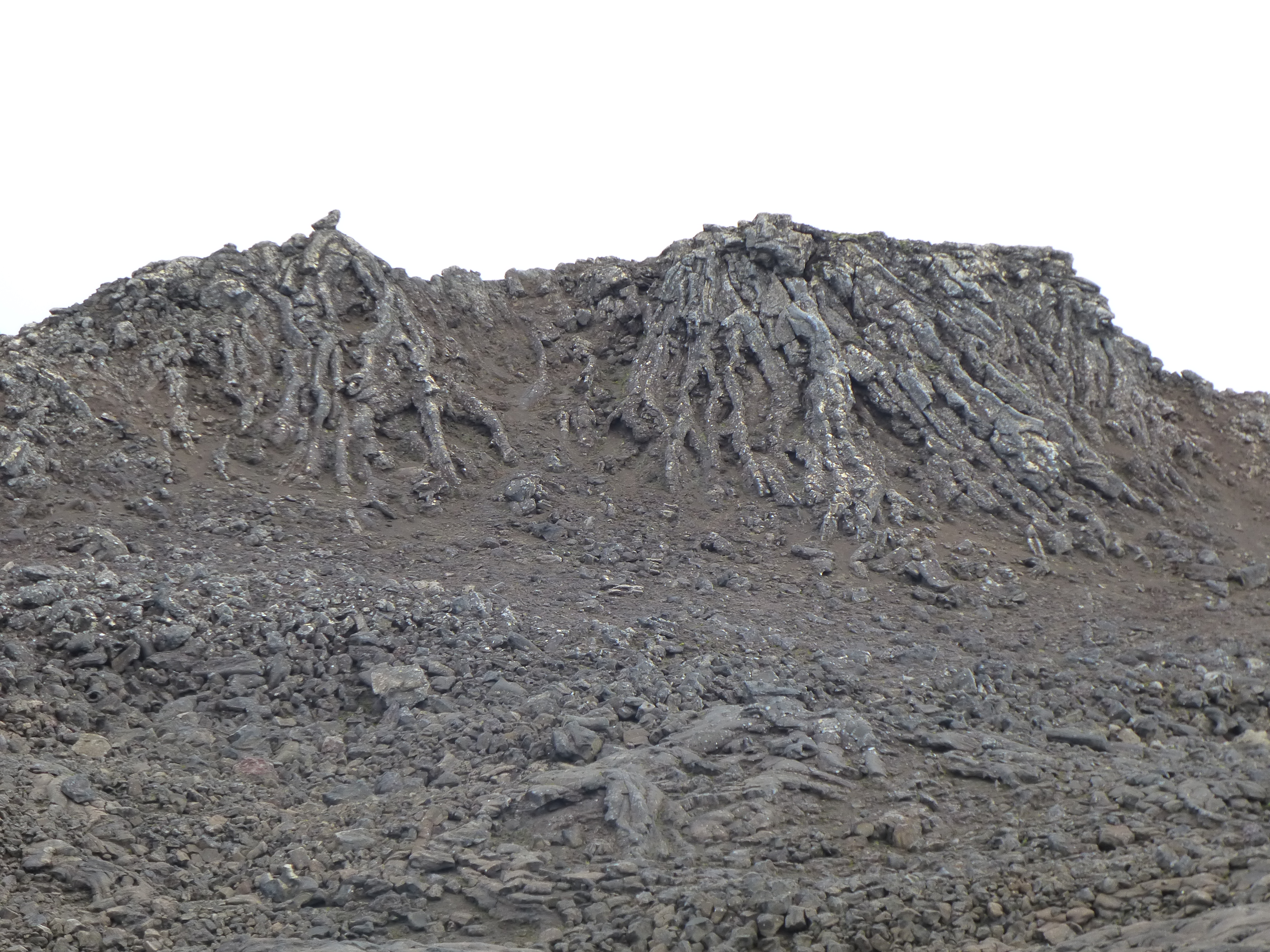
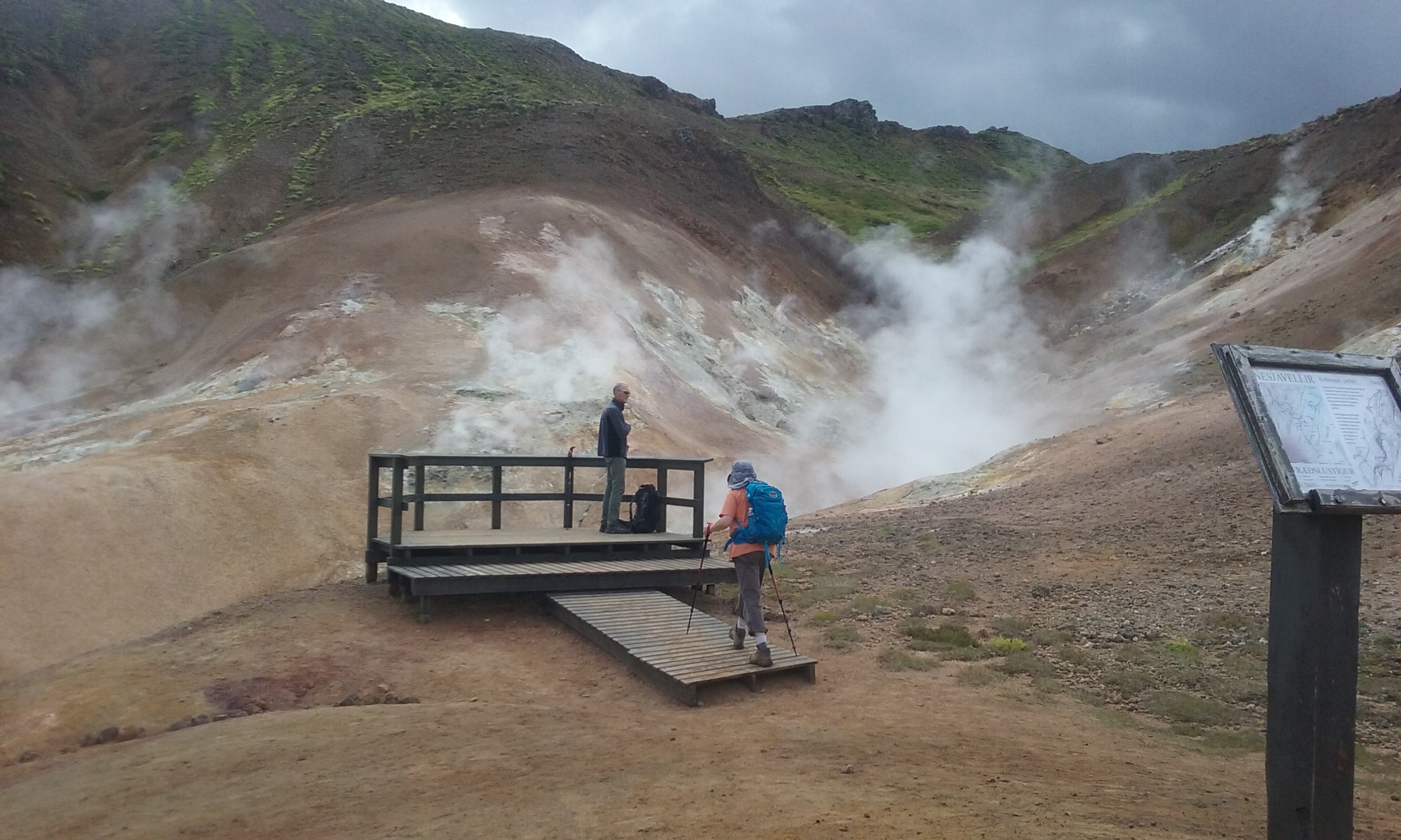
The trails became less developed the farther we went. It seemed they were used mostly by sheep and occasional birdwatchers. We saw swans on the water, heard and finally spotted a pair of loons. Among the grasses we observed pipits and wagtails, too. Occasionally we walked through a cloud of midges, but the bugs were cooperatively stationary, so they did not bother us much at all.

After cautiously crossing a marshy area and climbing over a small grassy hill, we were surprised to find some low stone walls and an archway, remains of a small building abandoned in the pastoral scenery above the lake. After snapping some photos and ascending one more hill, we wandered back through the tall grasses and returned up the road to the car.


Walking through the unknown countryside somehow made me think of the very first hike I had taken in Iceland, way back in 2007. The tour I was with had stayed in a grim workers´ hostel (small dark rooms and bathrooms, narrow halls, no fresh vegetables; I can’t remember how else it offended us) and hiked from its door into a geothermal wonderland. The lodging was close to the Nesjavellir Geothermal Powerplant, and it was surrounded by well-marked trails showing off the hot streams and colorful sulfurous soil that are features of the geologically-active area.

Before starting the hike, we visited a new hotel that has opened close to the site of the old hostel. The Hotel Ion is intended for international visitors who fly in for exclusive tours of Iceland’s highlights. I was a little surprised at the courtesy with which they welcomed three almost random hikers, but happy to take a coffee break in such elegant surroundings.20160731_064758

We drove a short distance to leave our car beside an adventure park that features a complex climbing structure with physical challenges for agile children and adults. We had a different adventure in mind. For the next couple hours we hiked past steamy streams, bore hole enclosures, neon green moss, carefully crossed narrow rocky creeks, and took in the views from wooden streamside platforms. After we had seen the highlights, Bragi returned for the car while Susan and I continued to a hilltop viewpoint beside a roadway. Our route didn’t always follow the developed trails, so we surprised pairs of grazing sheep more than once.

20160731_073307

From there we drove to nearby Thingvellir (Þingvellir in Icelandic), a UNESCO World Heritage Site, as well as Icelandic National Park, both designations in recognition of its being the site of the world’s first parliament (Thing or Þing in Icelandic). About sixty years after the Vikings first settled in Iceland, the clans acknowledged they needed to get together to discuss and agree to laws they could live by. The clan representatives were appointed, not elected, and they were not able to record their decisions on paper, but these do not diminish their achievement. The representatives gathered from all over Iceland each summer, starting in 930. They camped under high cliffs that helped project the sound of speakers’ voices. They sat in council with their advisors and adopted laws, settled disputes and passed judgment on evil-doers.

016-imgp0887

We were lucky to visit Thingvellir late in the afternoon after the biggest crowds had gone. It was a fine ending to our patchwork day that was far more enjoyable than anticipated.