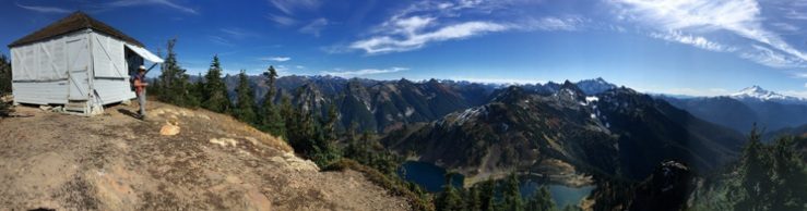
Sometime in the second half of 2021, free public access to the South Mountain Fire Lookout site through the surrounding private forest lands was eliminated by the Green Diamond Company. Until sometime that year, the long bicycling and hiking route to South Mountain, the southernmost peak of the Olympics, has been accessible from the Shelton˗Matlock Road, year round. Until this autumn, the forestland gates at that main road, and within the tree farm have been opened, allowing cars and trucks to drive to a gate four miles from the 3000-foot South Mountain summit, during the September through December hunting seasons. From there it has always been an enjoyable hike to the top.
Without any announcement beyond their website, Green Diamond developed and published new access maps for their forestlands in Mason and Grays Harbor Counties in 2021 (NEW – Grays Harbor/Mason County). The previous practice of press releases published in local newspapers, and listed on the company website News page: (https://www.greendiamond.com/news) was not followed. This information was probably shared within the company, and with current Recreational Access Permit holders. In the past, the public affairs office answered the phone for questions. This year no one answered the phone or returned my call to ask about the new maps.
There are five fire lookout sites in Mason County on land owned by the Green Diamond Resource Company: Dayton Peak, Grisdale Hill, Mason Lake, Simpson, and South Mountain. A recently discovered lookout site, White Star, is on Port Blakely Company land which is surrounded by Green Diamond Recreational Access Program land. When the company started its Recreational Access Program about a decade ago, free access to the Dayton Peak and White Star lookout sites was lost. In fact, the Green Diamond Recreational Access Permits sell out very quickly, and there is no such thing as a day pass.
The Green Diamond Recreational Access maps dated August 26, 2021, have lots of details. The Recreation Area ˗North Block map NEW – Grays Harbor/Mason County (updated 8/26/2021), includes the locations of South Mountain and the Simpson Lookout site. The main east west roads on this map are the Shelton Matlock Road, and State Route 108, between Kamilche and Elma. The Cloquallum Road is a fainter line on the map, running southwest to northeast between those two main roads. South Mountain and Simpson Lookout sites are north of the Shelton Matlock Road. The Dayton lookout site is between the Shelton Matlock Road and the Cloquallum Road, while the White Star lookout site is between the Cloquallum Road and State Route 108.
I discovered this map in mid˗Autumn. In late Autumn I drove from Shelton to Matlock and beyond to confirm the color coding on my 8 by 11-inch map. I first checked the gate on the north side of the Shelton˗Matlock Road between mileposts 10 and 11; it was open. The Green Diamond sign beside the gate displayed a big green dot, indicating the road was open to public motorized traffic. As I continued driving into the tree farm, I noticed Recreational Permit Required signs and closed gates on the left side of the road, and no signs on the right. After about 5 miles I came to a gated bridge on the main road. The sign beside the gate indicated a Recreation Permit is required to go farther. This gate is about 2.2 miles before the start of the hike to the South Mountain Lookout site. This confirmed the information suggested by the color blocks on the new Green Diamond Map.

Then I drove the Shelton˗Matlock Road all the way to the gate that leads to the Kelly Lookout site, on the Mason ˗ Grays Harbor County border, to confirm that hiking route is not within the new Recreational Access Program boundary. On my return trip I stopped at the access point for a short hike to a locally reputed Aircraft Warning Service station, Brehmeyer Hill. There are large cement barriers blocking this access point rather than a gate, and now there is a sign post with a Recreational Permit Required sign. Someone has added a less formal sign across the cement barriers:
This is the kind of thing that happens in western Washington forests. “Road, trail, and weather conditions change. Property ownership and use regulations change.” (Lost Fire Lookout Hikes and Histories: Olympic Peninsula and Willapa Hills. Author’s Note, p.329.)
When I discover a route is no longer accessible, or I learn a new route, I will post the update information on this website, with a summary message on the Fire Lookouts of Washington Facebook page.
