In October 2019 I organized a slide show about local fire lookouts for The Olympians Hiking Club in Aberdeen. I planned to share photos and what I knew and remembered from visiting all of the lookout sites in Grays Harbor County. Almost all of the historic fire lookouts there had been eradicated—with almost all signs of their existence removed before twenty-first century visitors arrived on the scene.
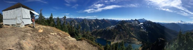
On my list was the Raft Lookout site, which I had hiked to several times in 2008-2010. I wasn’t including it in my book, because maps now show its location on the Quinault Indian Reservation, and the tribe no longer offers recreation permits for access on their lands.
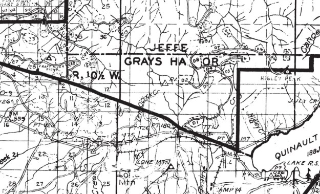
To gather a little history for my presentation, I looked in the lookout inventories published in the 1980s. I noticed that Raft is listed in Byron Fish and Ira Spring’s Lookouts; Fire Watchers of the Olympics and Cascades, but does not appear in either of Ray Kresek’s books about lookouts published in the 20th century.[1] Fish and Spring list Raft lookout under the Olympic National Forest and Olympic National Park, Quinault Ranger District. It describes it as a “Lookout shown on Forest Service map and not on USGS.” They located it in “Township 23 Range 11W Section 12, 10 mi. NW of Amanda Park.’[2]
At some point, based on the research of volunteer historians and lookout hunters like me, Raft’s name was added to the updated lookout lists in both the 2015 and 2019 editions of Kresek’s Fire Lookouts of the Northwest; Lookout Inventory Revised. The line for Raft says only “Raft… (see Salmon River).”[3]
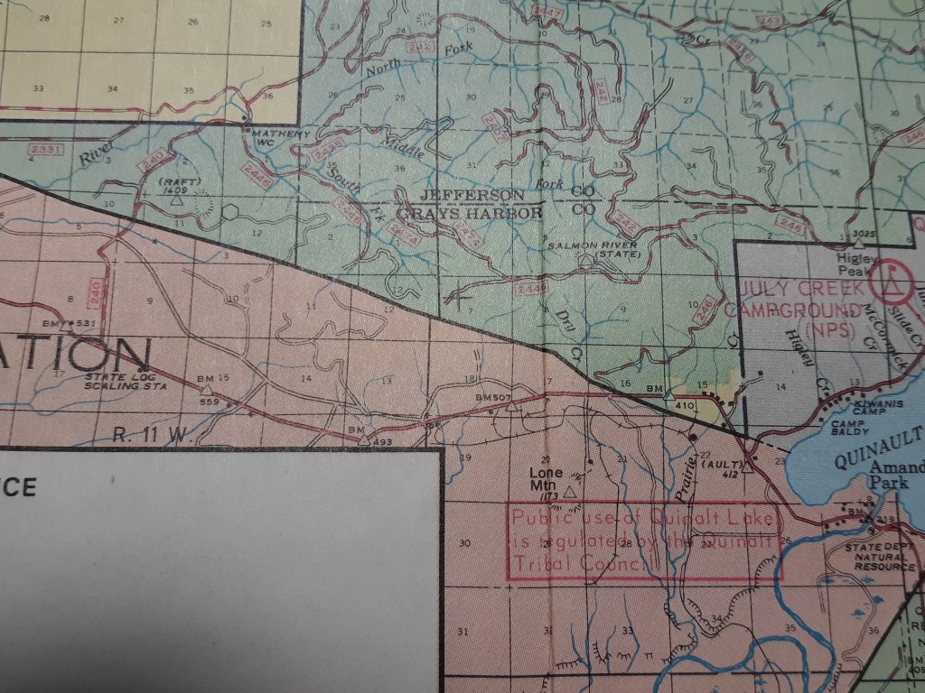
That surprised me, as I think of Raft as a federal fire lookout and Salmon River as state, so I pulled out my older maps of the region. Some have accumulated on our bookshelves along with hike guidebooks since we moved here in the 1970s, a few were gifts from older friends when they were downsizing, and one prize 1960 Quinault District Firemans [sic] Map had been sent to answer my questions about another fire lookout site. Several of these maps[4] show Raft as a forest service lookout in 1960 through 1976 at least, and Salmon River[5] as a state lookout—just as they are both listed in the Fish and Spring book.[6] At the talk, I had no photo of Raft Lookout to show, and only my map discoveries to support my scanty knowledge of Raft’s existence.
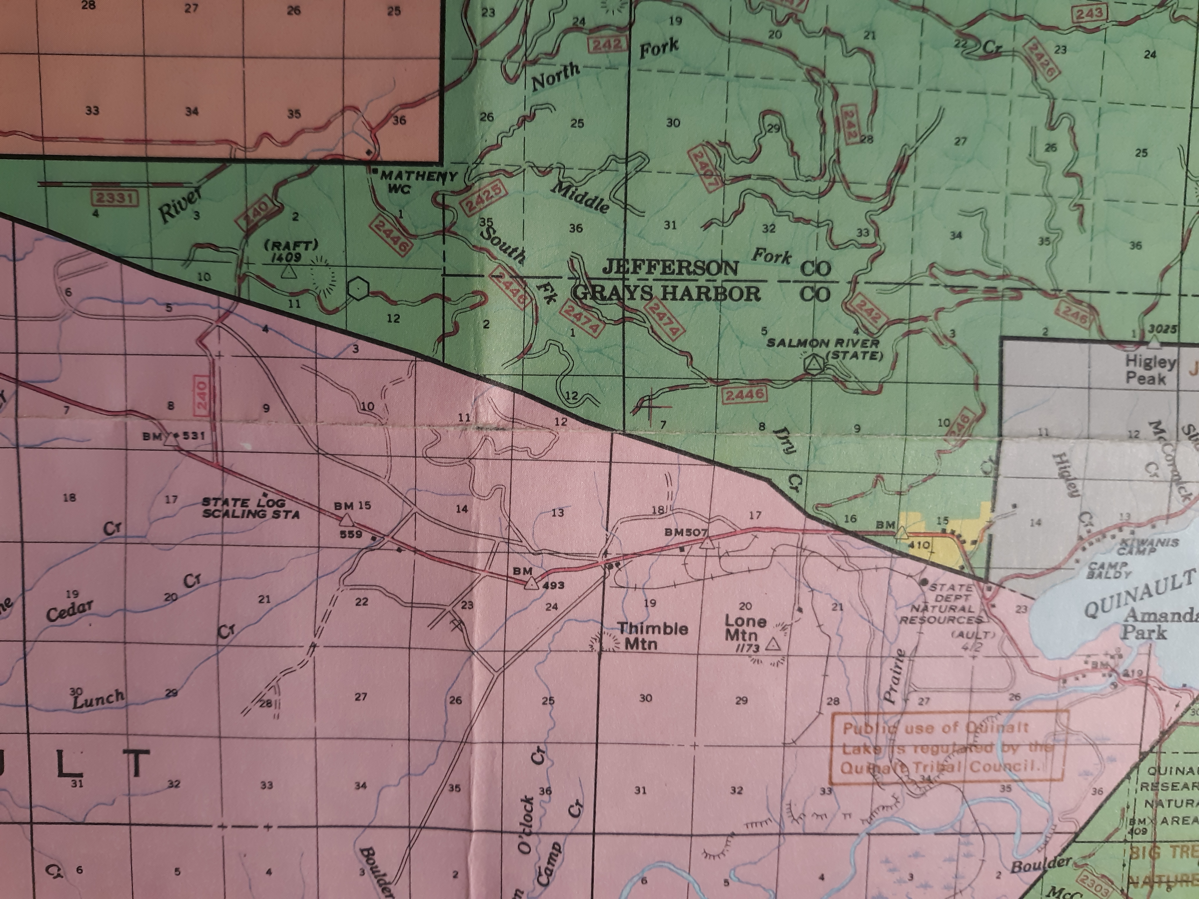
There wasn’t a large crowd for my Olympian slideshow, but a number of people stayed after the presentation to ask questions and share memories. I had hiked with more than half of the people in the room, so I anticipated hiking memories, and few questions. I was a little surprised when a frequent hiking companion from Elma mentioned that he remembered seeing the Raft Fire Lookout. He had worked for the Olympic National Forest several summers in the late 1960s, based at the Matheny Forest Service Work Camp. The Camp was located a few miles north of the Raft lookout, on Forest Road 240 (I think it is FR 21 on current maps) at the Jefferson County line.
The Raft Ridge Lookout, as he knew it, was one that his crew checked on regularly. He remembered there had been a house trailer on the site in 1968, ‘69 and 1970. His other clear memory was looking down on the Lone Mountain Lookout tower,[7] across US Highway 101 to the southeast, in the Quinault Indian Reservation. The Raft Fire Lookout, even without a tower sat at 1600΄ or 1700΄ elevation, while the Lone Mountain Tower added a 90΄ metal tower to its 1173΄ hilltop elevation.
The combination of symbols on maps and the memories of an elder forest worker resolved the Raft Lookout question for me. Byron Fish and Ira Spring were correct to trust the US Forest Service map when they included Raft as a federal Forest Service fire lookout in their 1983 book.
That left one related mystery for me—how, when and why was the land that had included both the Raft and Salmon River Fire Lookouts transferred to the Quinault Indian Nation? I recently learned the area was known as the North Boundary Expansion Area.
… But that is a story for another day.
[1] Ray Kresek, Fire Lookouts of Oregon & Washington, 1985 and Fire Lookouts of the Northwest, 1984.
[2] Fish and Spring, p. 197. [1] Kresek, 2015 and 2019, p. 23.
[3] Ray Kresek, Fire Lookouts of Oregon & Washington, 1985 and Fire Lookouts of the Northwest, 1984.
[4] Fish and Spring, p. 197.
[5] Kresek, 2015 and 2019, p. 23.
[6] Quinault Ranger District, Olympic National Forest, Firemans [sic] Map, 1960; Olympic National Forest map, 1972; Olympic National Park and Olympic National Forest. 1977.
[7] The Salmon River Lookout is documented elsewhere as in use from 1960 until about 1995.
[8] Byron Fish and Ira Spring. Lookouts; Fire Watchers of the Olympics and Cascades, 3rd edition, 1998, pp 197, 199.
[9] After several attempts, I reached Lone Mountain’s partly overgrown metal tower in September 2007. The tower was visible to travelers driving south on Highway 101 until 2012, when it was taken down for safety reasons.