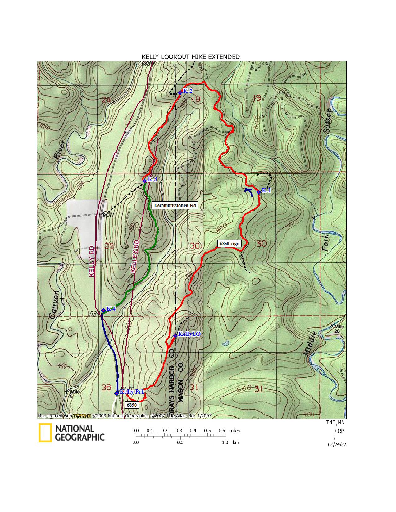
I have always enjoyed hiking to the Kelly Lookout site on the Mason ˗ Grays Harbor County border, and wondered where the roads connecting with the hike route go. Knowing the fire lookout station was on a low elevation ridge between the Middle Fork Satsop and the Canyon Rivers, with lots of hills and valleys interspersed, has intrigued me. Maps of the area are spider webbed with gated forest roads, making it an attractive area to hike throughout the year.
The map below shows a 6.5-mile loop route with several side roads (thin black dotted lines) you may want to add to your exploration. Start at the junction of the gated Green Diamond Forest Road 6850 with the main haul road through the area, which has several names and no road signs in 2022. My 2007 National Geographic Topo digital background map labels it the Kelly Road. Washington DNR quadrangle maps of similar vintage label it the 500 Road. I remember seeing a road sign with that number, but I have also seen it called the 6800 Road— a number that is appropriate for the Green Diamond road number system.
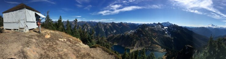
Hike up the road from the gate. It soon turns a corner and levels out a bit, then rises again a couple times before reaching the critical Y at about 0.75 mile. Keep right at the Y junction to visit the Kelly Fire Lookout site. Chapter 43 has a more detailed description, if you would like one.
After visiting the fire lookout site with its green painted artifacts, the first option is to continue down the hill to a logging landing which currently has clear views into the valleys east and west. The rivers are not visible, but forested slopes and landscapes shaped by millennia of water carving through rocks and soil spread in all directions.
Return to the Y (where you kept right to visit the Kelly Lookout site). Turn right to continue around the loop. The route is comprised of narrow roads curving through rolling forestland. The curves prevent long views of the road ahead. Tree harvests in this century provide intermittent side views into broad forests as the hike route continues northeast. Self ˗seeded hemlock sprouts border the roadway, along with vigorous salal. The forest is generally a mix of Douglas firs and hemlocks, with occasional cedars and alders.
The next major junction is at a corner with a 6850 road sign on the left. A side road on the right leads southeast, toward the Satsop River. I have not followed that branch. If you do, and it leads to a riverbank, please let me know. The loop route heads north from here.
At K˗1 on the map (coordinates 47° 17′ 07″ N, 123° 29’’35″ W), follow the road left into a shadier section of the forest. The attractive uphill road on the right unfortunately ends in a logging landing in about a quarter mile. Continuing on the main route is a better choice here.
This section of roadway travels northwest, with one surprise in the forest landscape. There is a logger’s memorial on a tree beside the track. A tin logger’s hardhat has been fastened high on a sturdy tree trunk on the right side of the road. It has been there long enough for bark to grow over the hardhat’s rim. A plastic vine with red flowers is draped over tree limbs just below the silver hat. Several other memorabilia, including a date plaque (12˗10˗12), sit at the foot of the broad tree base.
Not far beyond this landmark, the route turns left at a gate and continues a short distance southwest to reach K˗2 on the map. K˗2 marks the junction with a side road on the right that could have a panoramic view west—if a few trees fell or were felled. Only narrow gaps between the trees were found when the 0.4˗mile spur was explored in 2020. Perhaps it has improved.
Turn left at K˗3 to include an interesting decommissioned road in the hike route (at coordinates 47° 17′ 11″ N, 123° 30’’36″ W). The landscape slopes downhill on the left toward an occasionally visible valley, and uphill on the right. The 1.2˗mile road was closed with two sets of berms and ditches. The first set is shallow; walking around the berm and across the depression requires little if any close attention. The second set has higher berms and an eight-foot-deep ditch with a usually thick mud bottom. An eight-foot-long split tree trunk and rocks were left in the winter mud in 2022 as a temporary aid for foot traffic. Cross with caution.
Although we lacked a thermometer to test our intuitive assessment, the last section of the decommissioned road seemed significantly cooler than the rest of the route. In early February 2022 the only patches of snow we saw on the entire hike were beside the road in this part of the route. It does not have the highest elevation on the hike, and it did not appear especially shady, but it was definitely cooler. A look at the map reveals this section of the path parallels an unnamed creek that runs into the Canyon River a half mile west of the Kelly Road. The nearby creek may well contribute to the cooler microclimate experienced here.
The decommissioned road ends on a maintained gravel road which is gated at its junction with the 500 or Kelly Road. Turn left at K˗4 on the map. Hike 0.6 mile to return to the trailhead and your vehicle. Keep an eye out for the creek crossing under the roadway in a forested valley. It is one of the subtle waterways that were the first designers of the area’s interesting landscape